Phase One 100 Megapixels with 80-mm-Lens
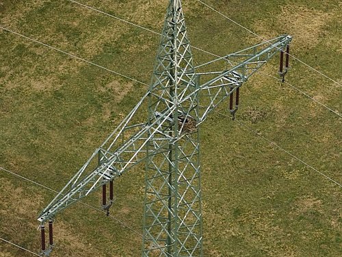
Seeking further improvements in the powerline-inspection business, Germandrones and Mitnetz came up with a Phase One mount for the Songbird to view power poles from a diagonal angle. This setup can be equipped with an 80 mm lens, leading to high quality imagery and a productivity level which is a USP in the drone inspection business. With a level of detail comparable to that of photos taken by multicopters from much closer distances, the Songbird can still cover tens of kilometers in a single flight at high speed
- View larger image. Altitude: 45 m above the powerlines, groundspeed: 70 km/h (43 mph). Note: The original 100 MP resolution is too large to be shown here. If you’re interested in the original files or a product demonstration, please contact us here.
Phase One Ground-Station-Plugin
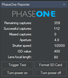
Our software team also provides a specialized plugin for the Phase One camera now. With the help of this tool the camera settings can be monitored during the flight, the shutter can be triggered and the payload may be turned on or off.
Direct Georeferencing
Direct Georeferencing is a method to precisely determine the position and orientation of an airborne sensor such as a camera or laser scanner. This makes it “possible to assign a geographical location on the earth to a pixel from a camera image or a digital point from a laser, without the need for ground control points or any additional measurements referencing the ground.” [1]
In this context, Germandrones has integrated Applanix APX-15 units together with Phase One cameras. This makes for a very accurate mapping solution and can be a valuable addition to any photogrammetry setup, for instance. If you’re interested to integrate this or other direct georeferencing units with your payload, please leave us a message!
Surveillance Cameras
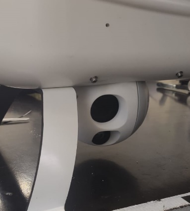
The integration of Merio Temis XL gimbal cameras was showcased in this news section before. Specialized day- and night vision cameras with high resolutions and sometimes additional features such as laser pointers often exceed the size of the internal payload container of the Songbird UAV. Nevertheless, custom solutions are an option and in case of the Temis have led to the successful development of a setup that is unique in this size and price class of drones.
Task-oriented Mission Planning Tools
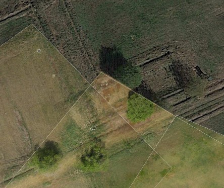
Special tasks sometimes require specialized software solutions. Don’t hesitate to ask us for potential integration of the functions you need. For instance, in the case of inspection functions, our planning toolset has been extended by a corridor tool, ideal to define flights along power lines, train tracks, pipelines etc. You first define the track and then the parameters for the inspection: At which lateral distance (or distances) should the drone fly along to the track (multiple fly-bys are possible)? What trigger intervals are needed? The screenshot illustrates this function.

In our latest software build, surveillance tasks can also be automated: While you can still use the joystick for live control of the Nextvision Colibri or Merio Temis cameras, you can also pre-define points of interest now that will be filmed automatically and return the footage even if the live link is disturbed, jammed or otherwise dysfunctional.
Contact:
Dr. Klaus Scho, CEO
takeoff@germandrones.com
Tel. + 49 (0)30 34 78 12 81


